We own 3 LiDAR sensors that will be use at a different scenario. A basic LiDAR system with 3 pulse returns will be use in urban area which required less vegetation penetration. Area that have a large vegetation coverage and many canopy, we use LiDAR sensor with 8 pulse returns or 16 pulse returns. With more pulse returns, LiDAR mapping allows us to pierce the vegetation and provides a high level of precision: up to 5 layers of foliage and 1 cm to 3cm of accuracy. Call us for complete presentation or POC. More information on our LiDAR sensor: LiDAR Survey
Photogrammetry Mapping
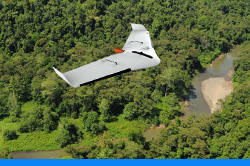
The Delair UX11 is a fixed-wing professional mapping drone offering significant productivity gains, unprecedented ease of use and high quality aerial data acquisition. With UX11, we can map 300 ac / 120 ha at 400 ft / 120 m and get a 1.7 cm GSD.
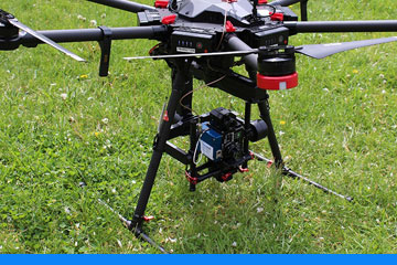
Our latest DJI Matrice 300 RTK comes with ZenMuse H20 and our fix wing drone comes with sony camera (42 MP sensor).
Hyperspectral Sensing
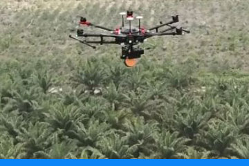
Hyperspectral sensing can be used to monitoring plantation or forest which it ‘spectral signature’ will help to determine vegetation healthiness, species, diseases and nutrients level. Our hyperspectral camera is a light weight system which can be mounted on UAV.
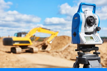
Topographic Survey
Topographic is a complete-service specialist in land surveying and mapping for traditional and emerging energy technologies. The topographic family brings its clients the tested value of historical knowledge and traditional customer service values, but with all of the investment value of innovative technologies producing best-in-class results.
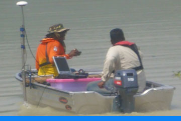
Hydrographic Survey
Hydrographic surveyors provide the surveying and mapping tools necessary to monitor coastline erosion, provide data for hurricane recovery programs, measure depths and computer volumes for dredging projects, locate and map submerged obstructions, and prepare for underwater construction. Our teams of highly experienced and accredited hydrographers conduct surveys globally for Government agencies, the Oil & Gas, Energy, Telecommunications and Marine Renewables sectors.
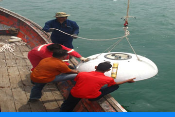
Oceanographic Survey
We can collect data from micro-ripples on the seabed to continental shelf scales. We are also capable of performing a range of high quality data collection methods that provides its clients with the necessary data resolution. Our tasks involves investigation of Wave, Current, Tide and Wind Sediment, Characteristics of Water Quality, Ecological Survey, Estuarine Salinity Intrusion, Telemetry Station, Meteorology Station Monitoring, Sand Mining Related Investigations, Temperature and Nutrients, and Multi-disciplinary Environmental Parameters
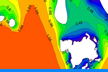
Numerical Modelling & GIS Analysis
We provides advanced numerical modelling with an objective, quantitative approach to identifying risk and enables the efficient use of this information as a powerful management tool. Our clientele includes coastal development companies, government agencies, and the consulting industry. Numerical modelling can be applied to any quantifiable problem in a broad range of contexts, including commercial, scientific and industrial processes, investment strategies and risk mitigation initiatives.
We have compiled tools and procedures to simplify data processing and analysis to provide a cost-effective service.
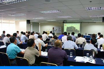
Training & Courses
AXIS GEMILANG’s training courses and seminars are developed in cooperation with recognized standards experts who thoroughly understand the issues and the requirements of effective standardization leadership and participation.
The Institute’s courses help standards and conformity assessment professionals effectively navigate the myriad processes and procedures of national and international standards development programs. These programs include technical training or courses on specific field, as these are the primary responsibility of AXIS GEMILANG’s members and accredited standards developers.