LiDAR SURVEY
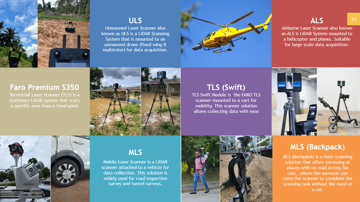
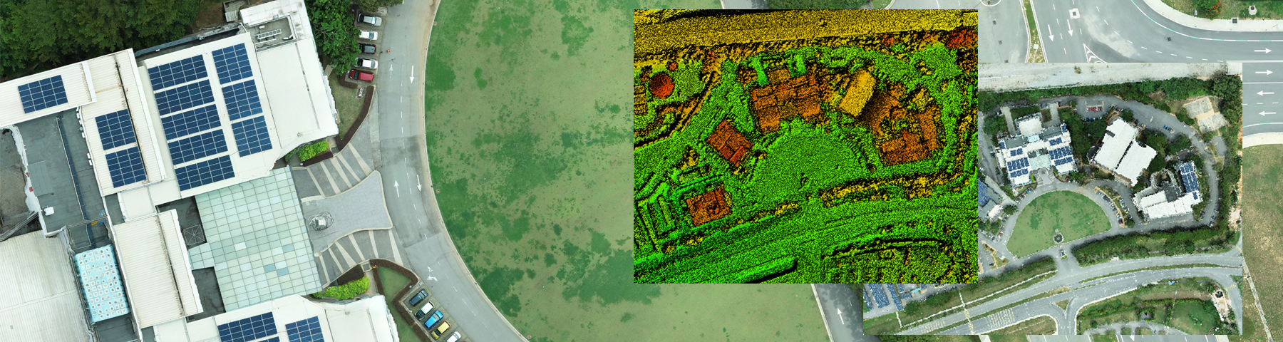
We offer wide range of LiDAR Survey including Terrestrial LiDAR System (TLS), SLAM LiDAR, Mobile LiDAR System (MLS) and Airborne LiDAR System (ALS). All Equipment and sensors are 100% own by us.
LiDAR has been use for various applications around Malaysia especially to assist in Surveying and Mapping since LiDAR can give a good accuracy. A LIDAR instrument consists of a laser, a scanner and a GPS receiver mounted on a platform. This platform may be mobile or stationary, aerial or terrestrial, based on the needs of the application — the laser, scanner and GPS receiver are the only constants.
ADVANTAGES OF LIDAR
LIDAR is a highly advantageous survey system for a range of industries, primarily due to the following factors:
- Speed: LIDAR can collect a million points of data per second, making it an exceptionally fast method of surveying. Scans of building interiors can last an average of three minutes, but even large-scale surveys can take under an hour to complete, making LIDAR one of the fastest surveying methods available.
- Accuracy: LIDAR systems collect extremely dense data with very little room between points. This means that the results are highly accurate, allowing professionals to plot and model natural and man-made geographies with the level of precision they need to plan detailed projects.
- Flexibility: When it comes to surveying land with LIDAR, there are plenty of options to choose from. LIDAR systems can be mounted on a variety of platforms based on the needs of an application. For small-scale surveying, a stationary tripod may suffice. LIDAR systems could also be mounted to airplanes, helicopters or drones to survey larger areas. LIDAR data can even be collected at any time of day or night since it uses light as the measurement tool.
- Safety: LIDAR systems work relatively quickly and can be operated from a distance, making them a good choice for locations that may be unsafe for human operators to stay for extended periods of time. Their ability to be mounted to aerial crafts also allows them to be used to survey dangerous areas that human surveyors may not normally be able to access.
In addition to these advantages, LIDAR can be integrated with other data sources with relative ease. Consult us now to know more.
Copyright © 2024 Axis Gemilang Sdn. Bhd. All rights reserved.